Tarfala Data
Mårmaglaciären
Mårmaglaciären is located approximately 25 kilometres to the northwest from Tarfala and Storglaciären in the Mårma massif. It is a valley glacier heading eastward with an average depth of 140 metres and a maximum depth of 270 metres. The glacier tongue is dammed inside huge ice cored moraines. The glacier has been subject to much research focusoing on its polythermal structure (Holmlund et al., 1996) and the possibility to extract paleoclimatic records from polythermal glaciers.
Mårmaglaciären was first documented by Enquist who photographed its tongue in 1918. The second documentation dates to 1952 when the glacier front was well documented by photographs taken by Valter Schytt. The moraines were examined by Østrem in order to estimate the thickness of the ice core in the ridges (Østrem, 1965). In 1968 the glacier was included in the glacier front monitoring programme.
Maps in the scale 1:10 000 has been constructed, based on aerial photographs taken in 1959, 1978 and 1991. Only the 1978-map was printed.
Monitoring data
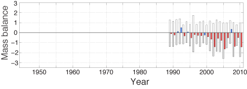
The mass balance of the Mårmaglaciären has been measured since 1990.
Time series
Winter mass balance, summer mass balance, net mass balance, equilibrium line altitude and ackumulation area ratio are available as time series in a single file.
Download data
- Calculated mass balance for Mårmaglaciären 1990–2011
- Calculated mass balance for Mårmaglaciären 1990–2011
Annual mass balance data
Data file and figure files in EPS format for a single year.
Download data
- Annual mass balance data
- Ablation gradient
- Net mass balance map
- Summer mass balance map
- Changes in specific mass balance (m) with elevation
- Winter mass balance map
- Snow density
- Time series of the annual mass balance
- Position of snow depth soundings and corresponding winter accumulation values (in metres water equivalent)
- Position of stakes and corresponding summer ablation values (in metres water equivalent)
- Distribution of net mass balance volume (m3) and area (m2) with elevation
- Annual report
Choose year
Graph
A graph of the Mårmaglaciären mass balance record. White bars represent the winter balance and grey bars the summer balance. The net balance is given as blue for postive and red for negative.
Publications
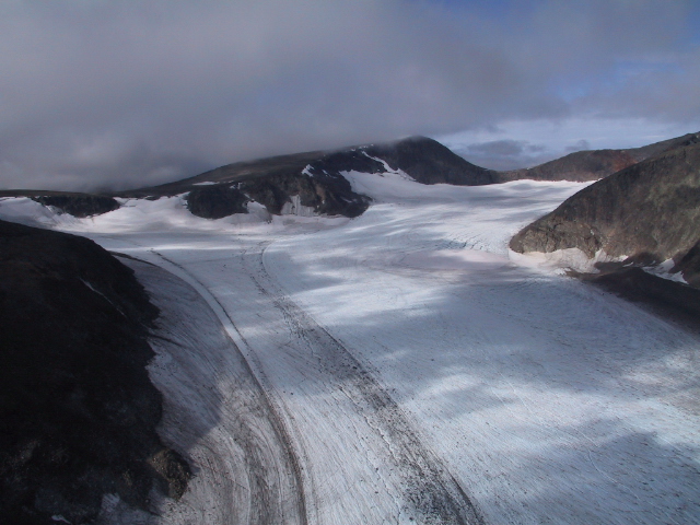
Mårmaglaciären in the upglacier direction towards the west. Photo: Per Holmlund.
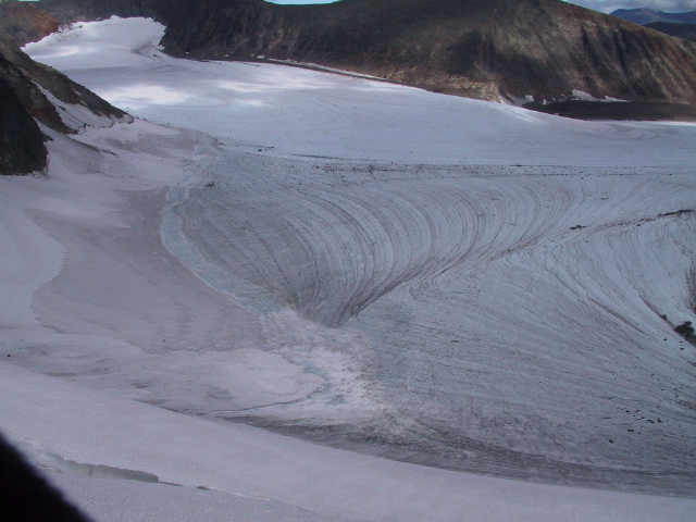
The upper parts of Mårmaglaciären towards the north. Photo: Per Holmlund.
| Location (WGS84) | 68°05'N, 18°41'E |
| Areal extension | 3.9 km2 |