Tarfala Data
Pollution
The fate of hydrocarbon pollution in Kebnekaise
A Super Hercules plane (model C-130J-30) crashed into the west-facing wall of the Kebnekaise, overlooking Rabot's glacier, approximately 50 metres below the rim between the mountain's north and south peaks on March 15, 2012. When starting from Evenes, Narvik, the aircraft had 14100 litres fuel, 50 litres hydraulic oil and 170 litres motor oil onboard. Best estimates are that at least 12.000 litres of fuel was sprayed over the mountain wall most of which was buried together with the wreck in a huge snow avalanche that was triggered by the impact in a north west facing cirque on Rabot's glacier between ca 1600 and 2000 metres (shown in the picture). Fuel decontamination was not possible because of the extreme impact site conditions. The Hercules airplane was fueled with JET A-1 (code 145163) which is a hydrocarbon product in the Kerosene/Jet Fuel category consisting of sweetened kerosene (CAS 91770-15-9) and hydrotreated light distillates (CAS 64742-47-8). The physical and chemical properties of each component (or block) of the hydrocarbon mixture influence its migration rate and fate. Some components of the fuel will volatilize, some are soluble in water but the vast majority are non-soluble.
During 2012 and 2013 we have traced and determined the chemical evolution of the polluted snow and ice at the source zone; estimated the meltwater and pollution transit time through the glacier and assessed the potential of biodegradation by microorganisms.
Please contact Gunhild (Ninis) Rosqvist for more information. The project “The fate of hydrocarbon pollution in Kebnekaise” is funded by the government (landowner Statens Fastighetsverk and by Formas).
Download data
Results of chemical analysis (OV21A package provided by ALS laboratories) of samples of snow from the source zone on Rabot's glacier. Snow was sampled regularly over the 2012 and 2013 melt season. Samples represent snow collected the 30 June 2013.
RD 0–150 represent snow sampled at site D, snow depth 150 centimetres. CDyt represent surface snow sampled at a position between site C and D.
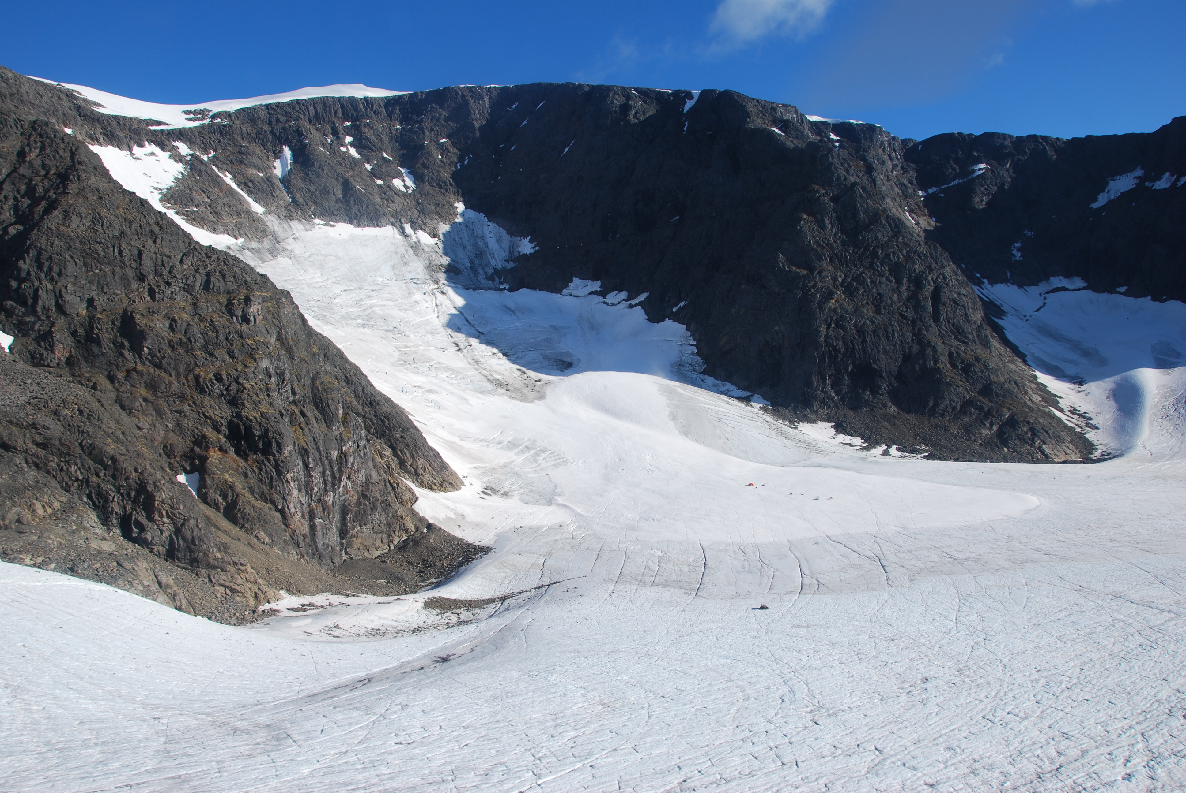
Photo: The upper part of Rabot's glacier. Photographer: G. Rosqvist.